
Be respectful and keep it clean!
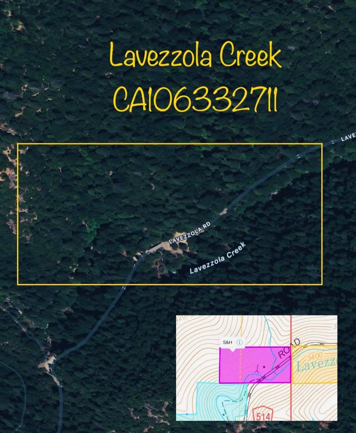
“Lavezolla Creek” Downieville, Sierra County, California.
Easy access with mostly paved roads. Approximately 2.5 miles of dirt road. Lots of good camping areas.
Lavezolla Creek is known for it’s large gold deposits and beautiful scenery. Only 15 minute drive from Downieville, CA.
Elevation: 4400Ft
Access: 4x4 not required in summer months. There is snow here in the winter time. BE CAREFUL! Mostly paved roads with a few miles of dirt road that most vehicle can handle.
GPS:
Parking GPS: 39.597934, -120.797888
NE corner: 39.599580, -120.794726
NW corner: 39.599145, -120.799891
SE corner: 39.597227, -120.799823
SW corner: 39.597170, -120.794648
Camping on or near claim: Yes, multiple areas to camp on. There is a large camping area right off the main road.
This claim has amazing and big gold! Very private and easy access. Drive up and mine within 50 ft of your vehicle!
Driving directions from Nevada City CA:
Turn left onto CA-49 N Heading to Downieville. 57 min (41.4 mi)
Continue straight onto Main St(348 ft)
Turn left onto School St, (62 ft)
Turn right onto Main St, (0.7 mi)
Continue onto Lavazzola Rd, (377 ft)
Continue onto Lavezzola Rd, (2.7 mi)
The Directions can be confusing, it is best to just find Lavezolla Rd in Downieville. Then follow it for approximately 2.5 mi. Once you get to where the road crosses the creek with a bridge you are there!